Dearborn County, Indiana
A unique mixture of agriculture and industrial enterprises with easy access to surrounding areas

The Dearborn County Surveyor's Office can make customized GIS (Geographical Information System) maps for the public. Prices vary depending on the size and customization of the map and are shown in the following table:

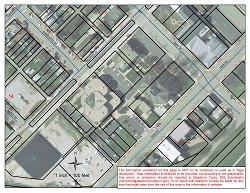
Below is a sample GIS map. These maps can be made in letter (8 1/2" x 11"), tabloid (11" x 17"), 18" x 24", 24" x 36", and 36" x 48". The largest width that can be made is 36".
Requests for maps can be made in person, or the Map Request Form (PDF) may be delivered to our office in person or by email to djeffery@dearborncounty.in.gov. Maps must be paid for and picked up in person. They will not be mailed.
An online subscription access for individuals is available through Dearborn County Government. An "Individual Subscription for Enhanced Web Access Service" (PDF) permits an individual user to view and print GIS data extracted from the County's electronic map. Data extractions (PDF) are also available from Planning and Zoning Director Nicole Daily at ndaily@dearborncounty.in.gov.
Site Design and Content Copyright © 2026 Dearborn County, Indiana
Site Design and Content Management System by CORE Business Technologies
